A committee mandated to coordinate and enhance geospatial services and information, involving all public sector agencies, academia, and relevant stakeholders.
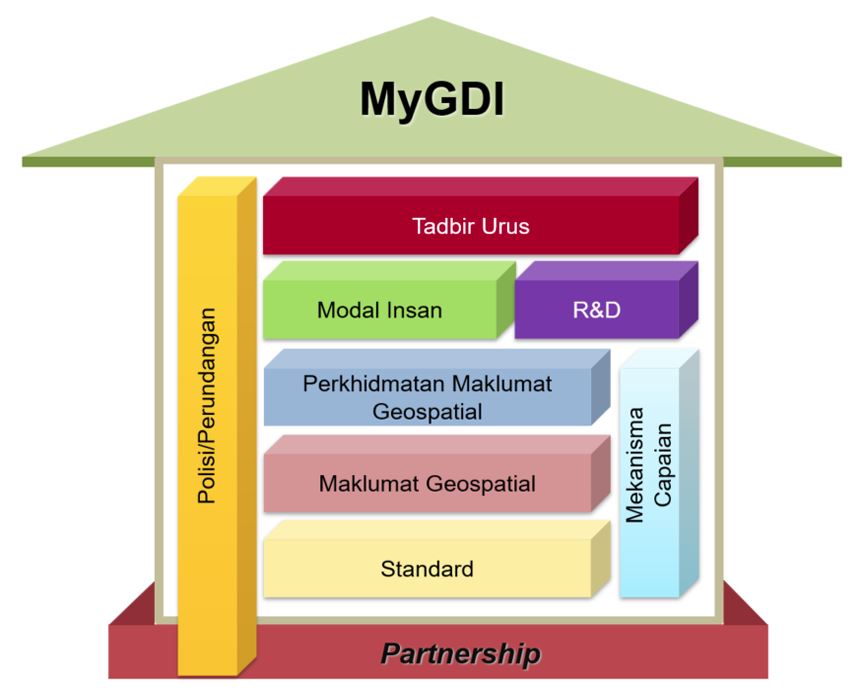
Human Capital
Providing training and competency development services within the geospatial sector
Research & Development (R&D)
Plan, implement and coordinate research activities for the development of geospatial data, technology, applications and GIS software.
Partnership
Strategic Partnership or Collaboration encompasses the sharing and dissemination of geospatial information through cooperation among various agencies under the MyGDI Program.
Geospatial Information Services
Providing a platform for geospatial information sharing and dissemination, as well as application development support requirements through the MyGDI Program
Geospatial Information
To manage and coordinate geospatial data for 12 categories to comply with MyGDI standards and quality.
Policy/ Legislation
The committee is responsible for coordinating and strengthening geospatial services and information involving all public sector agencies, academia, and relevant stakeholders.
Standard
To ensure that geospatial information under the MyGDI Programme complies with the standards by national and international standardisation bodies.
Access Mechanisms
Providing access mechanisms to geospatial information services that are always available, secure, and with integrity.