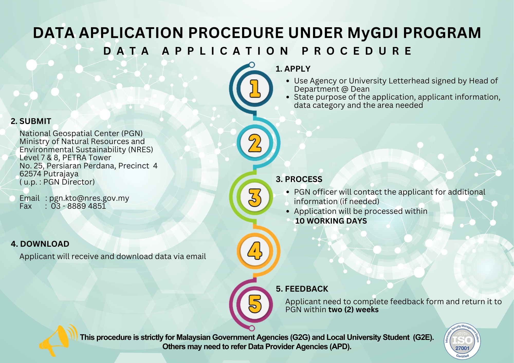
MyGDI Data Sharing and Release
Fundamental data refers to essential geospatial datasets identified based on user requirements, intended for sharing and dissemination under the Malaysian Geospatial Data Infrastructure (MyGDI) Program.
Geospatial information includes natural or man-made features within the airspace, land surface, subsurface, and maritime domains, referenced to a specific geographic coordinate system.
An information system designed to manage and interpret data related to events or situations that are geographically referenced to specific locations relative to the Earth.
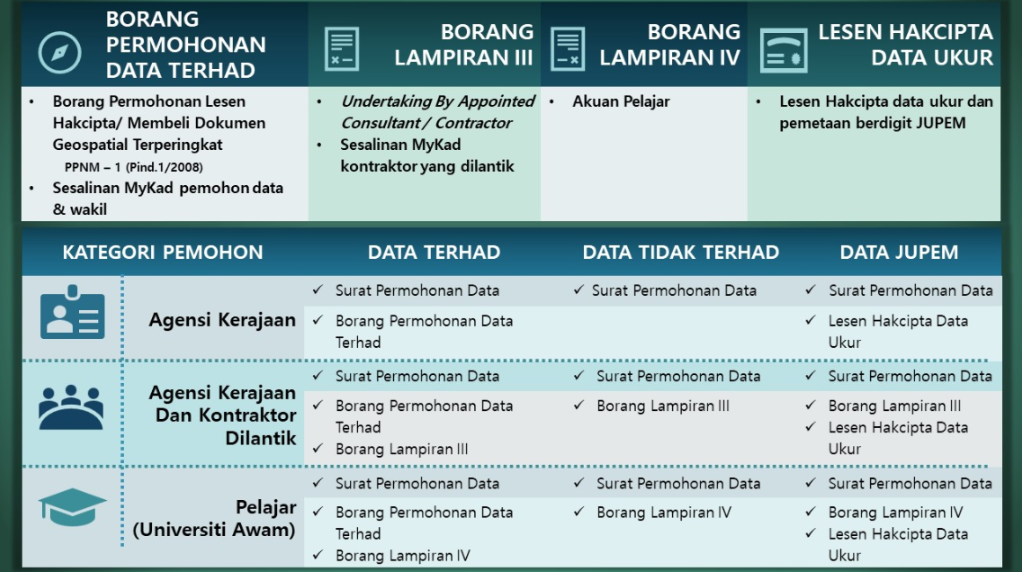
A custodian is an agency among geospatial data providers responsible for managing geospatial data.
A lead agency is an agency appointed as the head among data custodians, responsible for coordinating activities related to the data under the custody of the respective custodians.
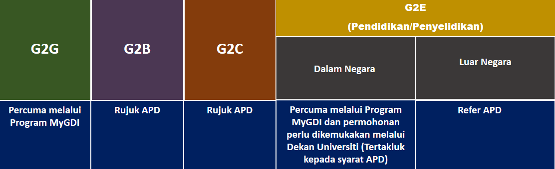
Nota:
- G2G: Perkongsian Agensi Kerajaan dengan Agensi Kerajaan
- G2B: Perkongsian Agensi Kerajaan dengan Agensi Swasta
- G2C: Perkongsian Agensi Kerajaan dengan Orang Awam
- G2E: Perkongsian Agensi Kerajaan dengan Universiti Awam
- APD: Agensi Pembekal Data yang merupakan pembekal atau pemilik data tersebut