Please wait...

Unique Parcel Identifier (UPI)

Search Codes and Names for Land Administrative

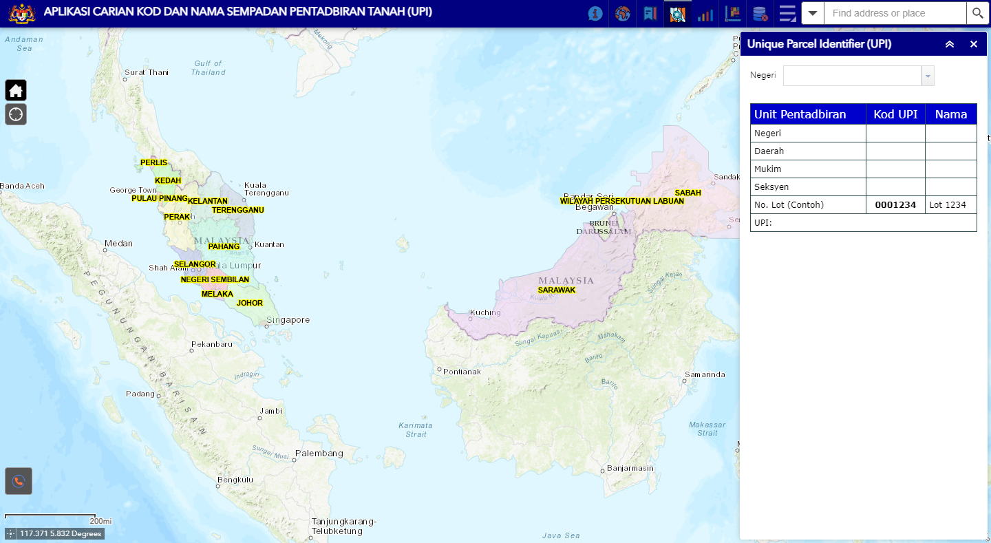
UPI is a unique method of identifying land parcels (lot) derived from a combination of finely grounded parcels of State,  District/ Jajahan/ Division/ Sub-District/ Jajahan kecil, County/ City/ Town/ Land/ Town District/ Desa, Seksyen/ Precint/ Block/ Section/ Village/ Island and lot/ Grant. The UPI application can display spatial and textual information for finely tuned landscapes and landmarks.


About UPI

The app was developed in 2008 and is being upgraded in 2016 to enable all government agencies to adopt code standards and domain names.

The use of a standard UPI ensures that data sharing between agencies is successfully implemented.


Benefits

Facilitate the implementation and integration of application systems within and between agencies

Facilitate the sharing of geospatial information

Assisting agencies in the application system development

Provides guidance on implementing uniform documentation across agencies


Features

Search for Code Structure and Landscape Boundary Names easily and the results are displayed in textual and spatial form

Basemap elections

Download Code Structure Document and Land Administration Boundary Name for 16 states in pdf format

Download Code Structure and Landscape Boundary Name in excel format

Print the map code results and land administration boundary name

Download the Manual