MS 1759

MS 1759 standard facilitates the sharing of geospatial data among agencies, encompassing data providers, suppliers, and users. It establishes methods for the encoding of geospatial data and provides standardized descriptions of relevant features and attributes.


MS 1759:2015   Geographic/ Geomatics Information
- Features and Attribute Codes

MS 1759:2015 Geographic Information/Geomatics – Feature and Attribute Codes

This standard outlines the method for encoding features and their associated attributes in a structured and explicit manner. Features refer to real-world objects, while attributes represent the information derived or collected from those features.

The MS1759 document is available for purchase through the Department of Standards Malaysia (DSM).


MS 1759 Search Engine

The MS 1759 Search Engine has been developed to enable online searches for features and attributes codes used in the development of the geospatial data. Searches can be conducted using categories and keywords. The search results will display the Feature Codes, Feature Names, Descriptions, Attribute Code and Attribute Name.


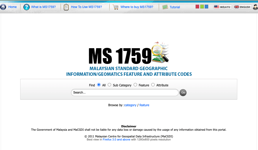
The MS 1759 application was initially developed in 2009, with searches referring to the MS 1759:2004 standard. It was subsequently upgraded in 2016 to support searches based on the MS 1759:2015 standard.

Target User

GIS Application Developers and Data Users.

Application Usage

Users can refer to code details and attributes.
  • The MS 1759 Application serves as a reference source for other agencies to ensure that geospatial data developed complies with Malaysian standards. 
  • This promotes more efficient and accelerated data sharing among government agencies.
  • Keyword-based search across categories, subcategories, features, or attributes
  • Bilingual interface (Bahasa Malaysia and English)
  • Visual display of item details
  • Overview and introduction to the MS 1759 standard